
The Vercors Regional Natural Park is a great playground for hikers on a preserved limestone plateau. The Vercors massif is located between the cities of Grenoble in Isère and Die in Drôme. Through more than 3000 km of marked trails and very diverse landscapes, here is a top 3 hikes to do in the Vercors, the time of a day.
The Grand Veymont
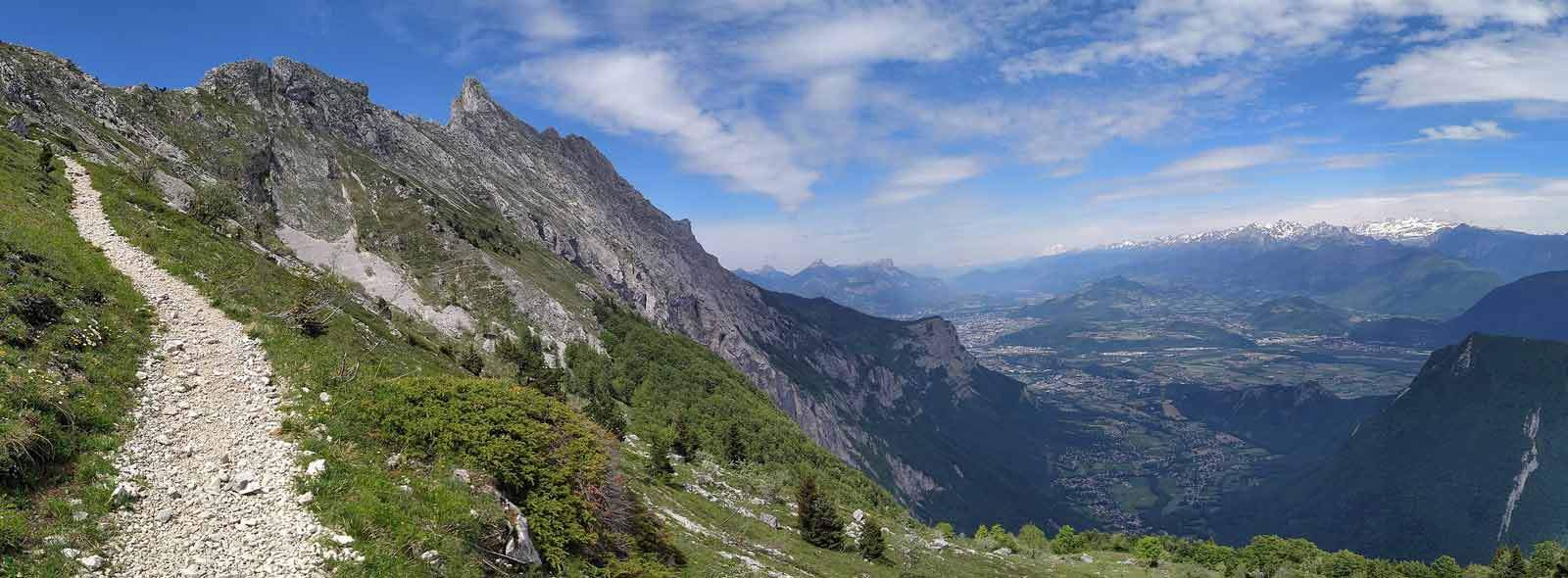
The highest point of the Vercors massif with its 2341 meters of altitude, the Grand Veymont offers a magnificent panorama over the Gresse Valley and the Vercors plateau. Sporty hiking, the ascent of the Grand Veymont has many surprises in flora and fauna.
Access from Gresse en Vercors is the shortest but not the least difficult. The hike lasts an average of 6 hours round trip over a distance of 13km and a drop of 1100 meters. The start is at the car park of the ski resort at the hiking post "Champ de l'herse".
The ascent begins by taking a wide path with the sign indicating the direction "Pas de la ville" which crosses meadows until arriving in the forest. After a few tens of minutes of walking, the trees begin to thin out and you arrive on a grassy and stony landscape. You will then have to take the winding path to Pas de la ville where you can observe ibexes and marmots and then turn left on the small path that leads to the summit. Arriving at the top, you can enjoy a 360° panorama and a breathtaking view of Mont Aiguille. The return is done by the same route or by the Pas des Bachassons.
This hike passes through the nature reserve of the Hauts-Plateaux du Vercors, specific regulations then apply such as the ban on hiking with dogs or even making fires.
Around Mont Aiguille
Going around Mont-Aiguille, one of the symbols of the Vercors massif remains an unforgettable memory. You can admire this limestone needle from all angles and hike on a varied route alternating between different types of landscapes. Without major difficulty, this 17.4 km hike lets you discover some of Trièves' architectural treasures and curiosities, including the Chapelle de Trézanne.
The hike begins in the parking lot of the hamlet of La Richardière, from which you must take the direction of Chichilianne as far as the Pont de Donnière and then reach the hamlet of Trézanne. After the Romanesque chapel, continue north towards Col de Papavet then Col des Pellas. Go back down to the "Chez Cotte" hiking post, passing through "Les Grand Clots", "Caraby" and the hamlet "Les Pellas". Take the paved road to the left towards the Parcours Aventure Trièves and climb to the "Col de l'Aupet". Then go down to "La Richardière" and return to your starting point.
The tour of Mont-Aiguille is an activity to do in the Vercors in summer and not recommended in winter because the passage of the Col de l'Aupet is dangerous.
The Moucherotte
The Moucherotte is the summit which dominates Grenoble as well as the valleys of the Isère and the Drac from the top of its 1901 meters of altitude. On a clear day, it offers an admirable view of the Chartreuse, the city of Grenoble with Mont Blanc as its high point.
It is a hike of medium difficulty which lasts on average 4h30 for a total distance of 12 km. The start of the hike is at the ski slopes of Lans-en-Vercors: from the snow stadium, you will have to pass in front of the 2 Virets ski lifts then take the wide track on the left which joins the GRP of the 4 mountains going up of Lans. Then follow the path which through the woods reaches the place called Ramées under the cross of the same name. Thereafter, continue the wide track to the summit of Moucherotte. The descent is done by the same track and at the level of the Combe de Nizier, you will have to turn left on the path which goes towards the Ramées hut, then the GR91 which will bring you back to the car park.
If the Moucherotte fascinates so much it is also because it is an exciting piece of ski history. At its summit (or rather just below) for more than 40 years, there was L'Hermitage, a luxury hotel accessible only by cable car leaving from the village of Saint Nizier du Moucherotte. A ski slope also linked the summit to the village.